Administrative Region Map Usage Method
Requirement Background:
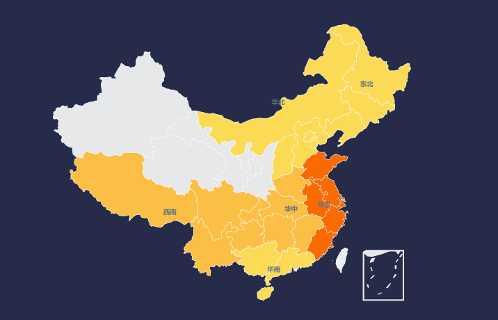
Sometimes we need to divide regions according to provinces and display them on the map. For example, Heilongjiang, Jilin, and Liaoning are divided into Northeast China, and Guangdong, Guangxi, and Hainan are divided into South China.
Implementation Method:
-
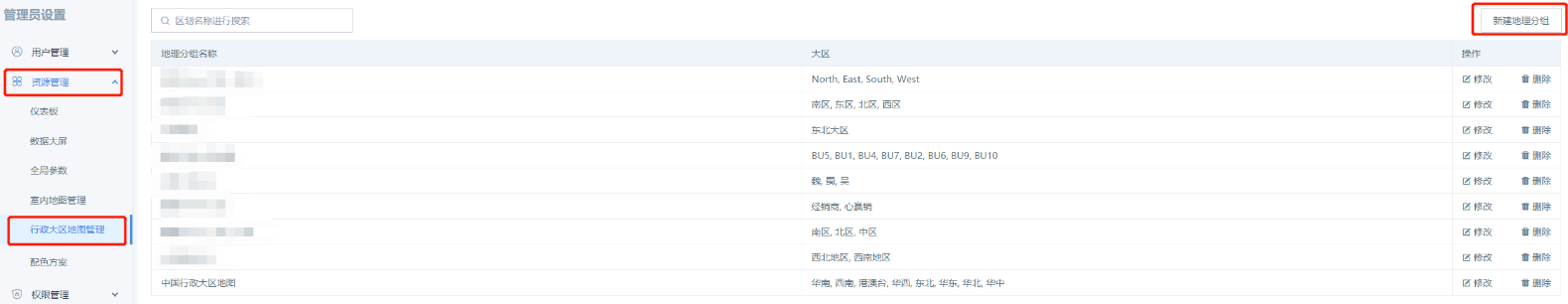
In Administrator Settings — Resource Management — Administrative Region Map Management, we can define regions ourselves, as shown in the figure:
-
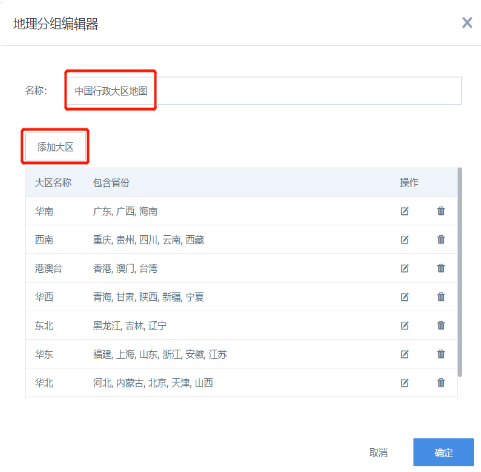
Click "New Geographic Region", fill in the "Name", here the example is defined as "China Administrative Region Map", click "Add Region" to customize regions:
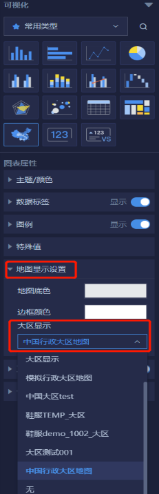
- After the regions are defined, we use the "China Administrative Map" card type, and in the "Map Display Settings" on the right side — "Region Display", select our defined "China Administrative Region Map":
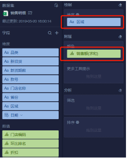
- Drag in the corresponding region field and color:
Result:
It can be seen that it already displays according to our desired regional classification:
Note: The dimension field dragged in must be a field defined according to the region, such as Northeast China, South China. You cannot directly drag in provinces.